


| Distance | 64,2 km |
| Difference in level | 1229 meters |
| Difficulty | Intermediate |
| Duration | 5 hours |
| Ground | Paved road |
| Recommended bike | gravel, mountain bike, e-bike |
| To view in the area | Ponte San Giovanni, Ponte Vecchio di Ponte San Giovanni, Ponte Valleceppi, Ponte Felcino, Villa Pitignano, Colombella, Piccione, Fratticiola Selvatica, Pianello, Ripa, Civitella D'Arna, Collestrada, Brufa |
| Staging points | 1-Ponte San Giovanni; - 2 Ponte Valleceppi |
| Interchange | Routes 6 |
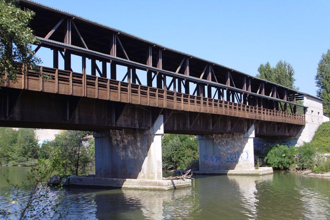
We leave Ponte San Giovanni and, proceeding along Via Ponte Vecchio, cross the wooden bridge, a construction that, since 2000, has replaced the medieval humpback bridge destroyed during the Second World War.
We take the Tiber river path that runs parallel to the river and reaches the village of Ponte Valleceppi, where it is possible to use the equipped rest area. Like other hamlets in the municipality of Perugia, its toponym indicates the presence of a bridge over the Tiber river, probably present since Roman times and used to connect Perugia to the municipality of Arna. The name of the bridge could derive from the fact that it was a natural point for collecting tree trunks, from the fact that the Tiber was dotted with tree stumps - understood as poplars - or because it fell, in medieval times, in the territory of a Mr. Cepo. Whatever its origin, Ponte Val di Ceppo was a fundamental junction since the Middle Ages, to the point that the Perugian painter Ignazio Danti depicted it, in 1583, in one of the forty frescoed maps kept in the Vatican Museums.
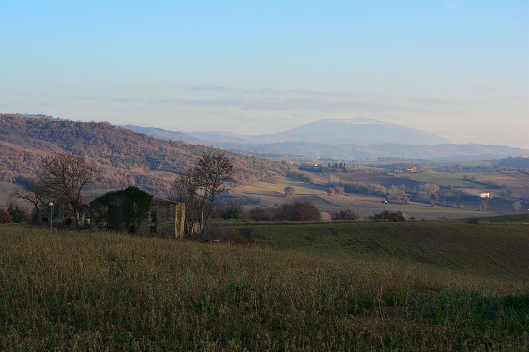
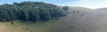
We then follow the cycle path to Villa Pitignano, after which we take a paved road that runs alongside Colombella, through Piccione and Pieve Pagliaccia. As we approach Fratticiola Selvatica, the eye fills with those woods that, in the Lombard language, gave rise to the place name. The appellation selvatica came later, when the castle lost its importance as a stop along the road connecting Perugia and Assisi to Gubbio. All that remains of the imposing octagonal structure in perpetual battle with water scarcity are the towers. Yet from Fratticiola Selvatica, located 668 metres above sea level, one enjoys a splendid view of the plain at the foot of Assisi.
We descend along a dirt road mixed with asphalt towards Pianello, lying along the Chiascio River, whose centuries-old history is inextricably linked with that of Civitella d'Arna, the next stop on our journey.
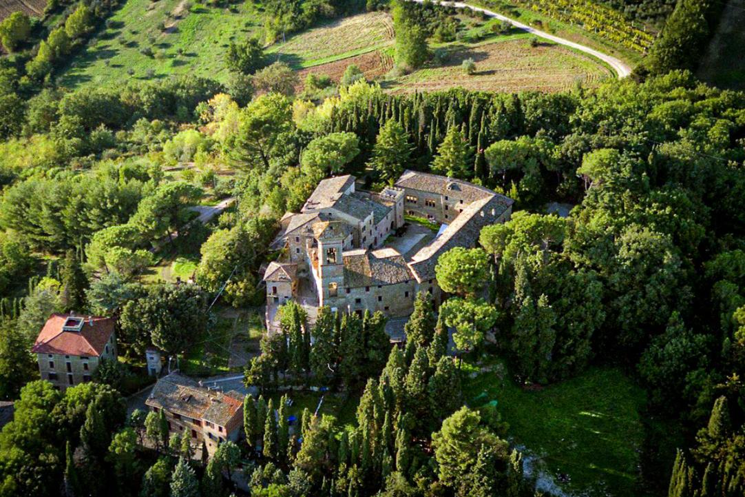
Their genesis is due to the ancient Umbrian-Etruscan town of Arna, whose name derives from the Etruscan word arno, river. The castle was probably first built following the siege of Perugia by Augustus, when many Perugini escaped the city walls and settled in this area. In this area that had always been disputed between Perugia and Assisi, two villages were founded in the 14th century, Villa Caimani and Villa Pianelli. The latter corresponded to the current centre of Pianello and began to be populated at the expense of the castle; it also developed thanks to its location along the route that connected the regional capital to Gualdo Tadino. But because of this, the settlement was also often sacked and destroyed, not only by bandits but also by the lords of the neighbouring lands, as a warning. Today, all that remains of the castle of Civitella d'Arna is the entrance bastion and an arch from the 14th century, as well as the Roman cisterns over which it was built. The inner parish church houses a gonfalon attributed to Bartolomeo Caporali and a panel painting by the Perugian painter Domenico Bruschi. From Civitella d'Arna one can see the outline of Perugia, with the bell towers of San Pietro and San Domenico, the Fortezza Paolina, the bell tower of the Palazzo Comunale, Porta Sole and the Monteripido Convent. On the opposite side, the eye sweeps over Assisi, Spello, Trevi, Bastia, the dome of Santa Maria degli Angeli and Foligno.
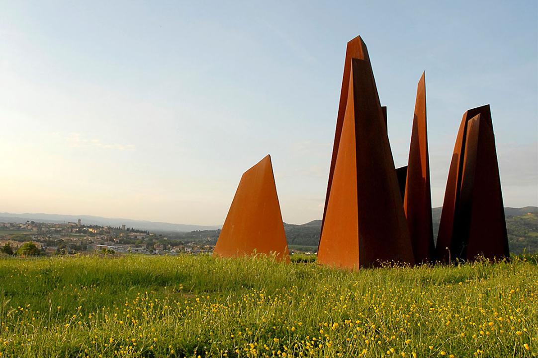
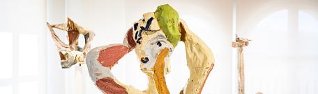
We now head towards Collestrada and follow the road that will lead us to the hill of Brufa, with its characteristic Sculpture Park: this is a permanent exhibition of works that, since 1987, has enriched the profile of the hill road that connects Ponte San Giovanni to Torgiano. We travel along it, downhill, to the locality Ferriera, from which we will soon reach the point from which we had started.
MORE DETAILS ON KOMOOT
Progetto Around Perugia - realizzato con il contributo della Sottomisura 16.7 PSR per l'Umbria 2014-2022