Bike Lane Assisi – Spoleto – Marmore
Ciclovie

Bike Lane Assisi – Spoleto – Marmore

Difficulty
Easy-Medium
Difference in level
650 m
Distance
98 Km
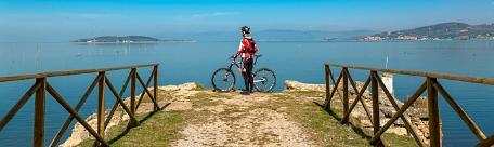
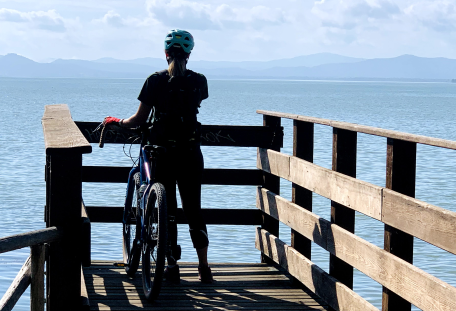
A bike ride in (quite) total relax: saddle up and ride along 98 kilometers of the bike lane Assisi – Spoleto – Marmore waterfalls!
Stages Assisi-Spoleto; Spoleto-Sant’Anatolia di Narco; Sant’Anatolia di Narco-Marmore Waterfalls
Distance Stage 1: 51 km | Stage 2: 18 km | Stage 3: 29 km
Difference in level Stage 1: 100 metri | Stage 2: 300 metri | Stage 3: 250 metri
Difficulty Stage 1: easy | Stage 2: medium | Stage 3: easy
Road surface Stage 1: asphalt | Stage 2: gravel road | Stage 3: 70% gravel road e 30% asphalt 
Bike recommended Stage 1: hybrid, mtb, ebike, racing | Stage 2: mtb, hybrid, gravel, ebike (with front lights) | Stage 3: mtb, hybrid, gravel, ebike
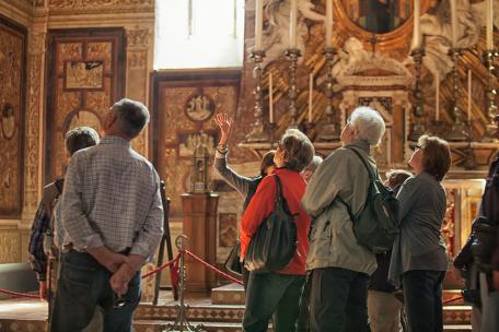
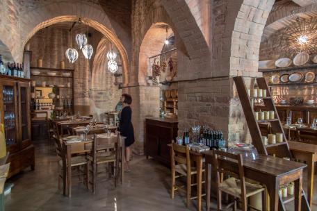
To visit in the area Assisi, Santa Maria degli Angeli, Rivotorto, Cannara, Bevagna, Torre di Montefalco, Casco dell’Acqua, San Giacomo, Spoleto, Caprareccia, Tassinare, Sant’Anatolia di Narco, Scheggino, Ceselli, Macenano, Ferentillo, Arrone, Castel di Lago, Marmore Waterfalls.


Born out of the conjunction of three different cycling routes, the bike lane Assisi – Spoleto – Marmore waterfalls tumbles into the eastern part of the Region, which passes through dozens of Municipalities among the province of Perugia and Terni.

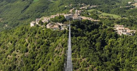
It is a path suitable for all, also for families with children in the easiest sections: with low and intermediate levels of difficulty, it is flattish and away from traffic for long stretches. This does not mean that is trivial, in fact: several sections are definitely suggestive, not including the beauty of the towns and villages that you meet along the way.

Let’s discover together the stages of this path!


Marker
Stage 1
Bike Lane Assisi-Spoleto

Length: 51 km | Difference in level: 100 m | Difficulty: easy | Road surface: asphalt | Bike recommended: hybrid, mtb, ebike, racing | To visit in the area: Assisi, station of Santa Maria degli Angeli, Rivotorto, Cannara, Bevagna, Torre di Montefalco, Casco dell’Acqua, San Giacomo, Spoleto.

Altimetria
Altimetry
Mappa
Map
Roadbook
Roadbook
GPX
GPX
PDF
PDF

It is the ideal combination between sport, nature and culture. Along the 51 kilometers of this path, you will stumble across or you will reach several typical villages of this region. Among the first ones, particularly known are Assisi, birthplace of Saint Francis and Saint Clare, and Spoleto, famous for the Two Worlds Festival and for coexistence of many artistic styles from the early Christian to the contemporary; between the villages crossed you will find Cannara, Bevagna, Montefalco and Castel Ritaldi

A second line runs parallel to this path, accessible by a less than 10 kilometers deviation, along which are located Foligno (town of the Quintana), and the villages of Spello e Trevi.
This bike lane is composed of two main segments: the first 23 kilometers, among Assisi and Bevagna, are mostly developed on secondary low – traffic roads; the second part, up to Spoleto, it is entirely with cycle lanes, offering a full protection from car traffic until the proximity of Spoleto downtown.

Read more
Marker
Stage 2
From Spoleto to Sant’Anatolia di Narco (through the old railway Spoleto-Norcia)

Length: 18 km | Difference in level: 300 m | Difficulty: medium | Road surface: gravel road | Bike recommended: mtb, hybrid, gravel, ebike (with front lights) | To visit in the area: Spoleto, Caprareccia, Tassinare, Sant’Anatolia di Narco.


Altimetria
Altimetry
Mappa
Map
Roadbook
Roadbook
GPX
GPX
PDF
PDF

If the first part of the path is that one more cultural – historical, the second one is that with a vocation more naturalistic and sportive: in the face of a reduced distance, the difference in altitude and the level of difficulty (even if only slightly) increase.

The requirements of the most adventurous cyclists will be granted, between woods, breathtaking landscapes and dark tunnels: these are the bequest of the old railway Spoleto – Norcia, masterpiece of engineering now disused and recently recovered to delight hikers.
There are two dutiful measures before starting this path: firstly, equip yourself with lights for your bikes to cross tunnels safely. Secondly, it is not recommended to walk this path if you are not well – trained. Ride safe!

⚠️ALERT PRACTICABILITY

TO STAY UP-TO-DATE ON THE PRACTICABILITY OF THE ROUTE, WE REFER YOU TO THIS LINK

Read more
Marker
Stage 3
From Sant’Anatolia di Narco to the Marmore Waterfalls (along the Bike Lane of the Nera)

Length: 29 km | Difference in level: 250 m | Difficulty: easy | Road surface: 70% gravel and 30% asphalt | Bike recommended: mtb, hybrid, gravel, ebike | To visit in the area: Sant’Anatolia di Narco, Scheggino, Ceselli, Macenano, Ferentillo, Arrone, Castel di Lago, Marmore Waterfalls.

Altimetria
Altimetry
Mappa
Map
Roadbook
Roadbook
GPX
GPX
PDF
PDF

The last 29 kilometers of this hike combine all the good we have met along the way: down the Valley of the Nera river nature and history go hand in hand, among the green vegetation and the presence of Medieval villages like Sant’Anatolia di Narco, Scheggino, Ceselli, Arrone, Ferentillo (famous among lovers for its climbing walls) and Castel di Lago: a stop is a must, to enjoy the small old towns and the local cuisine and also to relax your legs: the difference in altitude of this last part of the itinerary, although less than the second part, it could be too challenging, above all for those who are not trained.

Once recovered your strengths, you have to ride few kilometers of woods to reach the final goal, Marmore Waterfalls, the massive artificial waterfalls built by the Romans and over the centuries source of admiration to anybody. 
For sportsmen that still have energy to spend, around the waterfalls unfold six paths, of different length and difficulty, to fully enjoy the natural beauties of this place; for everyone else, the water splashes will bring relief against fatigue and they will be the right reward after many kilometers of activity! 

A recommendation: these Waterfalls do not always flow to the maximum range, but only during specific days and during certain times of day, which change during the year depending on the season.
Check the schedules and the Waterfalls opening days to fully enjoy their beauty!

 
Read more

INTERMODALITY

For various stages we have indicated several “access points”, easily accessible by public transport:

By train 
-You can reach several key hubs, or neighboring cities from where you can easily access the path; for example, Santa Maria degli Angeli (Assisi), Foligno, Borgo Trevi, Spoleto, Terni. You can find schedules and bike transport conditions on Trenitalia Website;

By bus
- You can carry your bike with a small fee along the drafts Terni-Marmore-Scheggino e Spoleto-Norcia. You will find information about fares and schedules on Fsbusitalia Website.