The Trasimeno Route
Hiking

The Trasimeno route

DIFFICULTY
Medium
DIFFERENCE IN LEVEL
500 m
DISTANCE
160 km
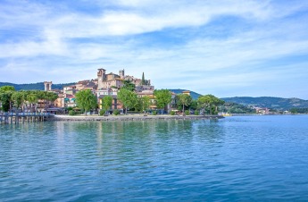
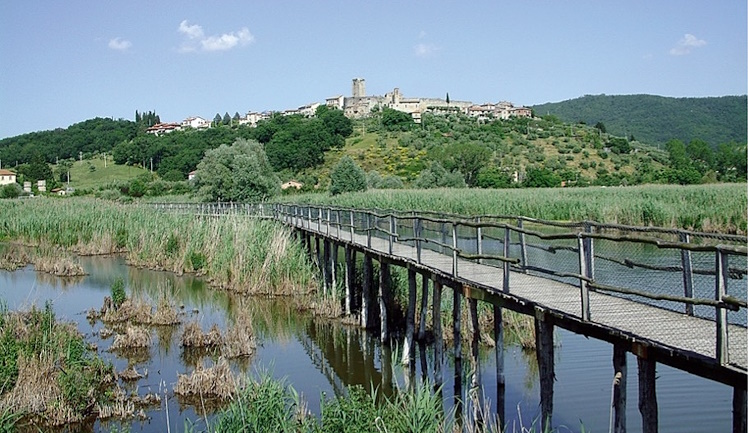
The Trasimeno route, a circular route of about 160 km through the beautiful villages of the area, with breathtaking views of the lake from the surrounding hills.
Distance 160 km
Difference in level 500 m (average)
Difficulty Medium
Walking time 7 days
Road surface asphalt and dirt road
To visit in the area Passignano, San Savino, Panicale, Città della Pieve, Villastrada, Castiglione del Lago, Isola Maggiore, Tuoro sul Trasimeno


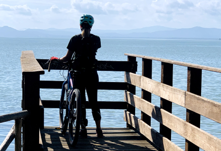
The Trasimeno route is a circular route divided into seven stages of about 22 km each. It is suitable for everyone: by mountain bike, for cycling enthusiasts; on foot, for more experienced walkers, for beginners and, why not, even in the company of their dogs.

The idea for the entire route is a project of the association “Camminare guarisce” (Walking Heals), which in 2018, involving local and regional institutions, created the itinerary, defining the ring-shaped path around Lake Trasimeno, using the paths already marked out by the C.A.I or other associations.

The “route” as a promotion of the culture of walking, with its symbolism of a slow, green and sustainable route.

Wear technical clothing and, depending on the weather, a hat or a waterproof cape. Backpack on your shoulders and off you go!

Below we suggest an itinerary that starts from Passignano but, given its circular nature, obviously does not have a fixed starting and finishing point.

The seven stages of the Trasimeno route:

Marker
Stage 1
Passignano – San Savino

Distance: 24 km | Difference in level: 691m | Difficulty: Medium | Walking time: 8h:30’ | Road surface: asphalt and dirt road | To visit in the area: Torre di Monte Ruffiano, Fortress of Passignano, Castel Rigone, Sanctuary of Madonna dei Miracoli, Isola Polvese, Isola Maggiore

The first stage starts in Passignano sul Trasimeno, a lively village, thanks to the numerous cafés along the lake, and rich in history. Walking through the narrow streets of the historic centre, one arrives at the Rocca, which offers a splendid panorama of the lake. The walk continues towards the hills above the village where it is possible to admire the Isola Maggiore and Isola Minore. You continue along a flat, open and scenic stretch of road and arrive at the tower of Monte Ruffiano, also known as the Torre delle Streghe (Witches' Tower). From there you reach a rest area located right next to the archaeological site “La Valle Nature Reserve”. Through olive groves, woods and vineyards, we reach the village of San Savino, which, from above the La Valle Nature Reserve, offers suggestive sunsets.

Track

Read more
Marker
Stage 2
San Savino – Panicale

Distance: 22 km | Difference in level: 672m | Difficulty: Medium | Walking time: 7h:30’ | Road surface: asphalt and dirt road | To visit in the area: Mongiovino Vecchio, Collegiate Church of San Michele Arcangelo, Church of San Sebastiano, Oasi la Valle, Castle of San Savino

San Savino, a small village on the south-eastern coast of Lake Trasimeno, is the starting point of the second stage. Dominating the village is its castle, a small fortress built in 1180, an important outpost for nearby Perugia, given its strategic position. Leaving San Savino behind, the itinerary continues until it reaches a forest, where most of the route unfolds. Wandering through woods, cultivated fields and olive groves, we arrive at Mongiovino Vecchio, a tiny village built around the medieval castle of the same name, which is currently used as an accommodation facility. The route proceeds towards the final destination of the stage: Panicale. This village, perched on a hill, has a history closely linked to its castle, which in medieval times served as a refuge.

Track

Read more
Marker
Stage 3
Panicale – Città della Pieve

Distance: 19,4 km | Difference in level: 676m | Difficulty: Easy | Walking time: 5h:20’ | Road surface: asphalt and dirt road | To visit in the area: Paciano, Museum of Glass of Piegaro, Cathedral of Saints Gervasio e Protasio, Oratory of Santa Maria dei Bianchi

From Panicale, we set off along the Trasimeno route towards Città della Pieve. Having passed the historic centre, the route climbs slightly among olive trees until it enters a forest of oak and chestnut trees, at the end of which it reveals the village of Paciano. This small medieval hilltop village is a treasure trove of architectural works enclosed by 14th-century walls. After a visit to Piazza Matteotti, the route continues along white roads surrounded by greenery. The last section of the itinerary, an open and undemanding route, ends with the arrival in Città della Pieve. Known for being the birthplace of the famous Renaissance painter, Pietro Vannucci, known as Perugino, this red-brick village is home to notable monuments of historical and cultural interest.

Track

Read more
Marker
Stage 4
Città della Pieve – Villastrada

Distance: 18.2 km | Difference in level: 382m | Difficulty: Easy | Walking time: 5h:40’ | Road surface: asphalt and dirt road | To visit in the area: Cantagallina, Villastrada, Church of Santa Maria delle Grazie

The fourth segment of the Via del Trasimeno involves a walk of about 3 km along the road travelled during the previous stage, to avoid busy roads. We pass the “Tre Mulini” farm and enter a wood that leads to the small hamlet of San Donato, consisting of a few clusters of small houses. Further on, having crossed the state road, the path continues along white roads and leads to the pretty hamlet of Cantagallina. A 30-minute walk takes you to the final destination of this stage: Villastrada, a small village with a few shops and accommodation facilities. The pride of the village is the Church of Santa Maria delle Grazie, built in the early 20th century by architect Ercole Crescenzi of Panicale.

Track

Read more
Marker
Stage 5
Villastrada – Castiglione del Lago

Distance: 25,4 km | Difference in level: 471m | Difficulty: Easy | Walking time: 6h:15’ | Road surface: asphalt and dirt road | To visit in the area: Rocca del Leone, Palazzo della Corgna, Sanctuary of Madonna della Carraia, Isola Polvese

Following a dirt road before the bar, we set off from Villastrada to reach Castiglione del Lago. On the way, which is in open countryside, we pass through several small hamlets including Gioiella and Vitellino to continue towards Lake Trasimeno. Eventually you arrive at your destination, in the picturesque lakeside village of Castiglione del Lago, now located on a promontory, but which until the lake’s waters subsided was its fourth island. It is a mediaeval town that contains monuments of great historical and artistic importance within its historical centre, such as the Rocca del Leone, dating back to the 13th century, whose patrol path offers a splendid panorama of the lake and its islands; also noteworthy is Palazzo della Corgna, built in 1560, with its richly frescoed interior.

Track

Read more
Marker
Stage 6
Castiglione del Lago – Isola Maggiore

Distance: 21.2 km | Difference in level: 29m | Difficulty: Easy| Walking time: 5h:30’ | Road surface: asphalt and dirt road | To visit in the area: Campo del Sole, Lido di Tuoro, Castle of Montegualandro, Museum of Lace, Church of San Michele Arcangelo

After a walk along the central avenue of Castiglione del Lago, a descent to the lakeside marks the beginning of the sixth stage of the walk. We leave the village behind us, following a pedestrian and cycle path that allows us to fully enjoy the beauty of the Trasimeno Regional Park. There are numerous resting and refreshment areas in the hamlets of Badiaccia and Borghetto, where there are campsites overlooking the lake. Once past Borghetto, the trail continues towards Punta Navaccia (Tuoro sul Trasimeno), crossing the territories of Hannibal's battle. From there we embark to reach Isola Maggiore, the final destination of this sixth stage. The island, which hosted St Francis in spiritual retreat, is the ideal place to breathe in the atmosphere of peace and tranquillity that permeates Lake Trasimeno. There are accommodation and catering facilities, as well as a small village that comes alive in the summer months. Points of artistic and cultural interest include the Museo del Merletto (Lace Museum), which testifies to the traditional local production of Irish lace, and the Church of San Michele Arcangelo, dating back to the 13th century and located at the highest point on the island. The church, richly decorated with valuable frescoes, is the ideal vantage point to celebrate the end of the stage by admiring a suggestive sunset over Lake Trasimeno.

Track


Read more
Marker
Stage 7
Isola Maggiore – Passignano

Distance: 29 km | Difference in level: 813m | Difficulty: High | Walking time: 8h:30’ | Road surface: asphalt and dirt road | To visit in the area: Hannibal Museum, Historical path of Hannibal’s battle, Church of Santa Maria Maddalena, Leaning tower of Vernazzano

After a restful stop on Isola Maggiore, for the seventh stage we set off by ferry back to Punta Navaccia, and then proceed to Tuoro sul Trasimeno. Located on the northern part of the lake, this village, one of the most important in the area, is known for the Battle of Hannibal that took place here in 217 BC. Evidence of this battle is collected in the Hannibal Museum located in the historic centre of the village, where you will also find the Church of Santa Maria Maddalena, defined by Pope Leo XIII as a “little St. Peter” for its 23-metre-high dome. The route then continues to Sanguineto, a small hamlet of Tuoro, and climbs up to the panoramic road, from which one can again admire the lake from above in all its beauty. Continuing along the path, we then reach Gosparini, another suggestive panoramic point, where it is possible to stop for a rest. After a few kilometres through woods and olive groves, we reach Passignano sul Trasimeno, an ideal destination for a pleasant walk along its lakeside promenade and to admire a wonderful sunset, toasting the end of the stage at one of its many bars.

Track

Read more

How to get there:

By car:

  • Autostrada del Sole (A1), exit “Valdichiana” for those coming from the north, exits “Fabro” and “Chiusi-Chianciano Terme” for those coming from the south.
  • E45, exit “Perugia”, direction Lago Trasimeno

By train:

  • Direction Milan-Florence-Rome: Castiglione del Lago, Chiusi-Chianciano Terme or Terontola stations
  • Direction Ancona-Foligno-Florence: Passignano sul Trasimeno or Tuoro sul Trasimeno stations

For further information:

Please refer to the website http://www.laviadeltrasimeno.org/