


ATTENTION: On the advice of the regional technical offices, the itinerary is not currently practicable. The Region of Umbria and Sviluppoumbria, each as far as they are concerned, are exempt from any liability in the event of non-compliance with this prescription.
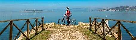
| Starting point | Cenerente (Perugia) |
| Finishing point | Cenerente (Perugia) |
| Distance | 25 km |
| Total ascent | 670 meters |
| Grade | medium |
| Road surface | 60% dirt, 40% sealed |
| Recommended bike | MTB, E-MTB |
| Places to visit in the area | Corciano, Perugia, Antognolla, Monte Tezio Park. |
There are no really steep stretches, but the long climb from Migiana di Monte Tezio must be added to the many ups and downs along the whole way, making it rather hard. The distance is suitable for everyone, however.
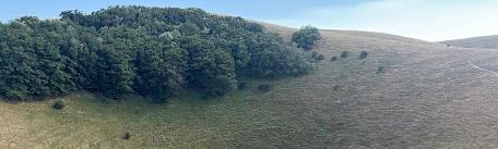
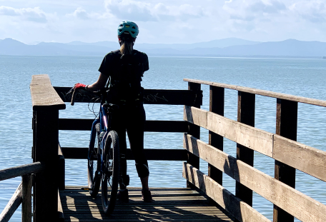
Starting from the church at Cenerente , the trail goes along sealed road towards Migiana di Monte Tezio (photo below right), then past Oscano castle and after about 1,5kms, it begins to climb gently. It continues uphill along sealed road until km5,6, where it turns left onto the dirt road that goes to Migiana di Monte Tezio, a beautiful natural balcony at km 7,5.
From here, it goes along the hillside though the woods for several kilometres, keeping left until km 11, when a steep descent to the sealed road below Antognolla castle begins (watch out for the chain across the road).
Here it turns left along the heavily trafficked SP169 road for about a kilometre, then, at San Giovanni del Pantano, it turns left again onto another dirt road uphill towards Pieve Pietroia. It continues for a few kilometres along the hillside, with several steep uphill stretches, to the Monte Tezio Park (km 18,2), another great lookout point. From here, the fittest bikers can continue climbing up to the left, along the marked tracks to the summit, while this route crosses the highest part of the carpark to the dirt track on the left that goes to the start of the descent. At km 19,6, in the middle of the descent, the trail turns sharp left then continues downhill. Close to a group of houses it turns right downhill again until it meets the sealed road at km 23. Here it turns right and in two kilometres it returns to the starting point.
The Monte Tezio Park (961 metres a.s.l.), about 10 kilometres north of Perugia and covering about 135 ha. The park borders with Corciano, Perugia and Umbertide territories and the hillsides are covered with various kinds of oaks and conifers. From Monte Tezio there is a beautiful view of the Tiber valley on one side and of Monte Acuto and Castel Rigone on the other. The little village of Capocavallo, clinging to the hillside, was first a villa then a fortified castle from the XV century. The bell tower has an unusual rococò style. Parts of the walls and a gateway are still visible.


