| Starting point | Ramazzano le Pulci |
| Finishing point | Ramazzano le Pulci |
| Distance | 29,5 km |
| Total ascent | 700 meters |
| Grade | medium-hard |
| Road surface | 65% dirt, 35% sealed |
| Recommended bike | MTB, E-MTB |
| Places to visit in the area | Perugia, Civitella Benazzone, abbey di Montelabate, Mills of Galgata. |
The route starts at Ramazzano, along the SP 175 Tiberina Nord, and travels through the North-East of Perugia, through the hills and woods that separate it from Gubbio. The trail is 29,5 kilometres long and has two main climbs (one is long, suitable for riding, the other is short, but very steep), making it possible to classify it as a medium-hard variation to route n.3, which goes from Perugia up the Tiber valley to Ponte Pattoli, passing close by Ramazzano
From Ramazzano the trail follows the SP 175 towards Casa del Diavolo and turns right at the first crossroad (km 1,2) towards Piccione and Montelabate. At km 2,9 it turns left and starts climbing towards the beautiful Abbey of Montelabate, at km 5,1. From here it goes uphill along path n. 202 to Belvedere, where the climb and the dirt track end at km 11,2.
The trail continues along the SS 298 for a few metres (beware of the traffic) then turns left at km 11,8 down another dirt road. It continues straight ahead for a few kilometres, but by turning right towards Biscina, bikers can pick up the “Cammino Francescano della Pace Assisi-La Verna” (St. Francis’ Way from Assisi to La Verna).
Pedalate per pochi metri sulla SS 298, prestando attenzione al traffico, e al chilometro 11,8 svoltate a sinistra imboccando un nuovo sterrato in discesa. Qui, proseguendo diritti per qualche chilometro e poi svoltando a destra in direzione di Biscina, ci si può immettere anche sulla Via di Francesco, altrimenti iniziate la discesa tenendo sempre la sinistra e seguendo le indicazioni per Galgata, fino a raggiungere Molino di Galgata, località nel territorio di Gubbio, da osservare sulla destra proprio sul fondo valle.
The trail decends to the left following the signs to Galgata, which is on the right at the bottom of the valley. The second climb of the trail starts here: it is less than a kilometre but has a very steep grade of up to 20%, obliging less trained bikers to dismount. At the end of the steepest stretch (km 16,6), the trail goes left to the main dirt road for several kilometres along dips and rises.
After the woods, the castle of Civitella Benazzone can be seen to the left, and at km 24,9 the trail returns to the Abbazia di Montelabate, where the dirt track ends.. From here, it turns right and returns to Ramazzano along the same route followed at the start.
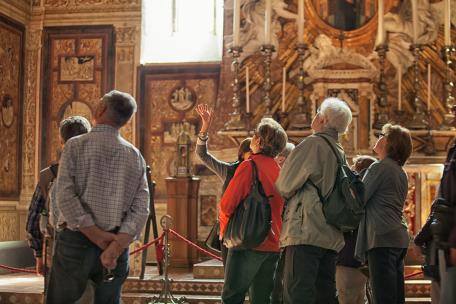
The centre of Perugia, just a few kilometres away, already described in the route starting from Ponte S. Giovanni. The most important building to be seen in the area is the abbey of Santa Maria di Valdiponte (better known as the abbazia di Montelabate, photo on left). This is a Benedictine monastery north of Perugia, founded between the IX and the X centuries. The monastery reached the height of its importance in the XI and XII centuries when it expanded its possessions and increased its hegemony over a vast area. After the XVI century it began a long period of decline which ended with the closure of the monastery in 1859-60. The monastery currently belongs to the Fondazione Gaslini of Genoa. The small fortified village of Civitella Benazzone, is also worth seeing along the way, but it is the natural beauty of the area that dominates the trail.


