| Distance | 44,5 km |
| Difference in level | + 1.100 m |
| Difficulty | medium |
| Road surface | asphalt and dirt road |
| Bike recommended | mtb, e-mtb, gravel |
| What to visit in the area | Spoleto, Piedipaterno, Vallo di Nera, Castel San Felice, Abbazia SS. Felice e Mauro, Sant’Anatolia di Narco. |
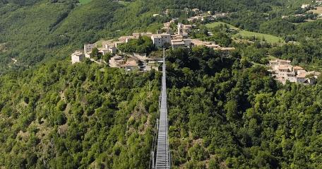
In 1926 was opened the railway line which used to connect the town of Spoleto to Norcia and at that time it constituted a small jewel of railway engineering: along the route, a little more than 50 kilometers, were built 19 tunnels, 24 bridges and some viaducts of great architectural value, with stretches of helical line and up to 4,5% pending.
The railway was closed in 1968 and, after many years of disuse, in July 2014 part of the route was converted into a cycle/pedestrian route.
At present, with a few detours, it is possible to get from Spoleto to Piedipaterno and then follow the final stretch of about 4 km leading from Serravalle to Norcia. We recommend this last segment only to those who are in Norcia and want to make a pleasant and easy round trip, since, as of today, it is not easily connected to the rest of the cycle route, except by means of busy roads.
From a cycling point of view, however, the most beautiful and enjoyable part is that which connects Spoleto to the Valnerina: about 26 km in which unpaved stretches of road alternate with detours on asphalt roads with little traffic. For many kilometres you can cycle along the old railway route, tackling viaducts and tunnels. The tunnels are not illuminated, which makes the experience even more adventurous, but requires the use of lights on your helmet or bike.
The entrance to the cycle route is near the Spoleto Nord junction, just outside the city, along the road to Forca di Cerro. The first 6.5 km run along the original route, always uphill, but with gradients never exceeding 4%.
Before the long Caprareccia tunnel (currently undergoing maintenance), it is necessary to leave the track in its own right and take the SR395 road to Piedipaterno, which is pleasant and has little traffic.
The road climbs slightly again for a couple of kilometres to the Forca di Cerro pass. Shortly after the pass, following the signs for Tassinare, you can take a road that, in a few bends, will take you back onto the route of the former railway to follow as far as the Valnerina.
On this downhill stretch there are a couple of slightly more technical and steep detours. Tackle them with caution or, if you do not feel up to it, proceed on foot, since it is only a few dozen metres.
At the end of the descent, you will have to travel a very short distance along the SS 685 road of the Valnerina before returning to the route of the former railway at the old Sant'Anatolia di Narco station (from where, going up towards Sant'Anatolia di Narco, you can cross the Nera cycle route, which, if you wish, leads to the Marmore Falls).
From Sant'Anatolia di Narco to Piedipaterno, the route of the former Spoleto-Norcia railway continues on its own track and is completely flat, also suitable for families with children.
Once you reach Piedipaterno, you have two options:
- return back along the same route;
- complete a ring itinerary by climbing up to Forca di Cerro along the SS 395, which is asphalted but has little traffic and no steep slopes. In this case, once you have passed the Forca di Cerro pass, you can return to the former railway track at the Caprareccia station.
SEE ROUTE DETAILS ON KOMOOT
TO KEEP UP TO DATE ON THE PRACTICABILITY OF THE ROUTE, WE REFER YOU TO THIS LINK
USEFUL RECOMMENDATIONS
- The surface of the former railway is good, but unpaved. The ideal bike to use is a mountain bike, or a gravel bike with suitable tyres.
- With the exception of the diversions before Sant'Anatolia di Narco, there are no difficult sections, but a minimum of riding ability is still required.
- The uphill slopes are always gentle, but you have to overcome several metres in height difference, so some training is required. For the less experienced, we recommend the use of an e-bike.
- Along the route, there are numerous tunnels without lighting, making lights on the bike or helmet indispensable.
INTERMODALITY
By car
- Highway “del Sole” A1 (Milano – Firenze – Roma – Napoli), for those coming from the North exit Valdichiana, for those coming from the South exit Orte.
- Highway “Adriatica” A14 (Bologna – Taranto), for those coming from the North exit Civitanova Marche, for those coming from the South exit San Benedetto del Tronto.
- Freeway E45 (Cesena – Orte), exit on SS 75 to Assisi, exit Acquasparta, then SS 418, exit Terni, then SS 3.
By train
- Line Roma – Ancona
- Line Roma – Foligno – Perugia – Terontola – Firenze
By bus
You can find on Busitalia website , and also news, all urban and suburban buses schedule of Spoleto and Umbria.


